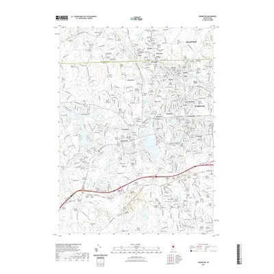
2021 Map of Crompton
USGS Topo · Published 2021About this map
Industrial villages and historical burial grounds line the waterway corridors of the North Branch Pawtuxet River and the South Branch. This territory at the Providence and Kent county line is defined by a dense network of settlements like Hope, Fiskeville, and Phenix, many established around the power of the river system. The landscape transitions from the developed mill towns of West Warwick and Arctic in the east to the more open terrain near Mishnock Swamp and Hungry Hill in the west.
Find a feature on this map
191 named features on this map. Tap any name to fly to it.
Don’t see what you’re looking for? This feature index may not catch every label — zoom into the map to look around manually.
Map Details
Editions of this 2021 Crompton Map
This is the sole edition of this map. No revisions or reprints were ever made.
Other maps of this area

1887 · Providence
USGS Topo · 1:62,500

1889 · Providence
USGS Topo · 1:62,500

1889 · Burrillville
USGS Topo · 1:62,500

1890 · Narragansett Bay
USGS Topo · 1:62,500

1890 · Kent
USGS Topo · 1:62,500

1892 · Narragansett Bay
USGS Topo · 1:62,500

1894 · Burrillville
USGS Topo · 1:62,500

1894 · Kent
USGS Topo · 1:62,500

1894 · Providence
USGS Topo · 1:62,500

1915 · Burrillville
USGS Topo · 1:62,500