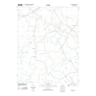
2010 Map of Cromwell
USGS Topo · Published 2010About this map
The Green River snakes in broad, sweeping loops across this Kentucky landscape, defining the character of the settlements and transportation networks. The river’s winding course creates prominent landforms like Big Bend and Little Bend, which historically influenced local ferry crossings and land use. The community of Cromwell sits near a strategic bend in the river, while smaller settlements such as Shultztown and Highview are scattered throughout the interior, often centered near family-named landmarks like Taylor Hill and Keel Hill.
Find a feature on this map
71 named features on this map. Tap any name to fly to it.
Don’t see what you’re looking for? This feature index may not catch every label — zoom into the map to look around manually.
Map Details
Editions of this 2010 Cromwell Map
This is the sole edition of this map. No revisions or reprints were ever made.
Other maps of this area

1909 · Hartford
USGS Topo · 1:62,500

1911 · Dunmor
USGS Topo · 1:48,000

1914 · Little Muddy
USGS Topo · 1:62,500

1914 · Dunmor
USGS Topo · 1:62,500

1925 · Spring Lick
USGS Topo · 1:62,500

1953 · South Hill
USGS Topo · 1:24,000

1953 · Rochester
USGS Topo · 1:24,000

1954 · Evansville
USGS Topo · 1:250,000

1954 · Horton
USGS Topo · 1:24,000
1954 · Paradise
USGS Topo · 1:24,000