
1953 Map of South Hill
USGS Topo · Published 1954About this map
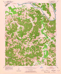
The Green River carves a winding path along the northern boundary of this Kentucky landscape, separating Ohio and Butler counties. At the time of this 1953 field check, the region was characterized by small agricultural and mining hubs, including the curiously named Mining City and the settlement of Provo. The geography is defined by a dense network of creek valleys, such as Muddy Creek and Hickory Camp Creek, which shaped the placement of local infrastructure and family homesteads. Cultural landmarks like Monticello Ch and Oak Grove Sch served as community anchors, while the southern reaches of the map show an active Oil Field with numerous Oil Wells. Several Strip Mines are also marked, illustrating the extractive industries that influenced the local economy alongside more traditional farming life.
Find a feature on this map
36 named features on this map. Tap any name to fly to it.
Don’t see what you’re looking for? This feature index may not catch every label — zoom into the map to look around manually.
Map Details
Editions of this 1953 South Hill Map
2 editions found
Other maps of this area

1909 · Hartford
USGS Topo · 1:62,500

1911 · Dunmor
USGS Topo · 1:48,000

1914 · Little Muddy
USGS Topo · 1:62,500

1914 · Dunmor
USGS Topo · 1:62,500

1925 · Spring Lick
USGS Topo · 1:62,500

1953 · Dunmor
USGS Topo · 1:24,000

1953 · Quality
USGS Topo · 1:24,000

1953 · Rochester
USGS Topo · 1:24,000

1954 · Evansville
USGS Topo · 1:250,000
1954 · Paradise
USGS Topo · 1:24,000