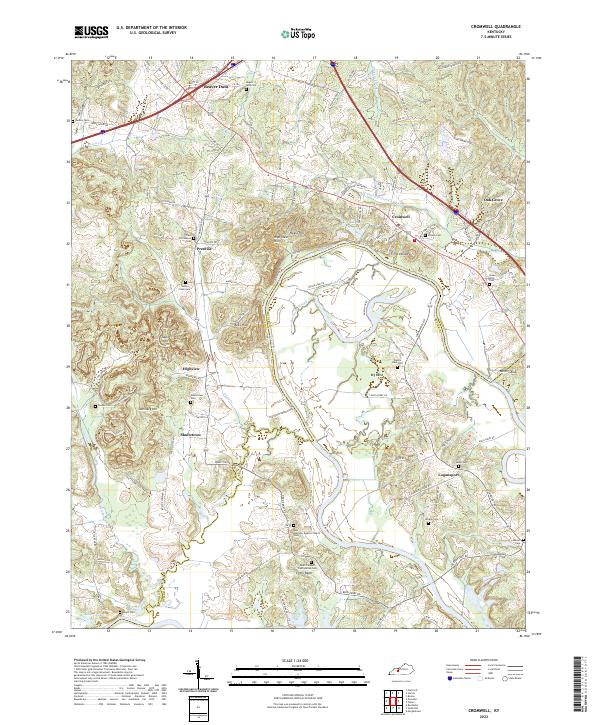
2022 Map of Cromwell
USGS Topo · Published 2022About this map
The Green River carves a deep, winding path through the borderlands of Ohio and Butler counties, defining the character of this rural landscape. This area is marked by a high density of family and community burial grounds, such as East Providence Cem and Slaty Creek Cem, reflecting a long history of local settlement. The terrain transitions from the low-lying Hurricane Slough to elevated landmarks like Negro Hill and Tilford Knob. Small rural hubs like Prentiss and Shultztown are connected by a network of named country roads and old ferry crossings, such as Reeds Ferry Rd and Annis Ferry Rd. These routes trace the historical movement of people and goods along the river’s oxbows, including the pronounced loop at Big Bend. The presence of the New Harmony Baptist Church and Point Pleasant Presbyterian Cem further anchors the social geography of this river-oriented Kentucky region.
Find a feature on this map
86 named features on this map. Tap any name to fly to it.
Don’t see what you’re looking for? This feature index may not catch every label — zoom into the map to look around manually.
Map Details
Editions of this 2022 Cromwell Map
This is the sole edition of this map. No revisions or reprints were ever made.
Other maps of this area

1909 · Hartford
USGS Topo · 1:62,500

1911 · Dunmor
USGS Topo · 1:48,000

1914 · Little Muddy
USGS Topo · 1:62,500

1914 · Dunmor
USGS Topo · 1:62,500

1925 · Spring Lick
USGS Topo · 1:62,500

1953 · South Hill
USGS Topo · 1:24,000

1953 · Rochester
USGS Topo · 1:24,000

1954 · Evansville
USGS Topo · 1:250,000

1954 · Horton
USGS Topo · 1:24,000
1954 · Paradise
USGS Topo · 1:24,000