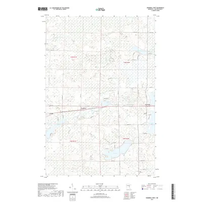
2019 Map of Cromwell West
USGS Topo · Published 2019About this map
Cromwell and Wright sit along the east-west rail and road corridor in this 2019 survey of western Carlton County. The landscape is defined by an intricate network of wetlands and water bodies, where the Tamarack River and Little Tamarack River wind through a terrain dotted with numerous lakes. Small settlements like Woodbury are connected by a grid of township roads such as TWP RD 181 and TWP RD 1, which navigate around significant basins including Eagle Lake and Tamarack Lake.
Find a feature on this map
55 named features on this map. Tap any name to fly to it.
Don’t see what you’re looking for? This feature index may not catch every label — zoom into the map to look around manually.
Map Details
Editions of this 2019 Cromwell West Map
This is the sole edition of this map. No revisions or reprints were ever made.
Other maps of this area

1953 · Duluth
USGS Topo · 1:250,000

1958 · Duluth
USGS Topo · 1:250,000

1961 · Cromwell
USGS Topo · 1:62,500

1963 · Gowan
USGS Topo · 1:24,000

1963 · Prairie Lake
USGS Topo · 1:24,000

1969 · Automba
USGS Topo · 1:24,000

1970 · Little Prairie Lake
USGS Topo · 1:24,000

1970 · Wright
USGS Topo · 1:24,000

1980 · Duluth
USGS Topo · 1:100,000
1982 · Heikkila Creek
USGS Topo · 1:24,000