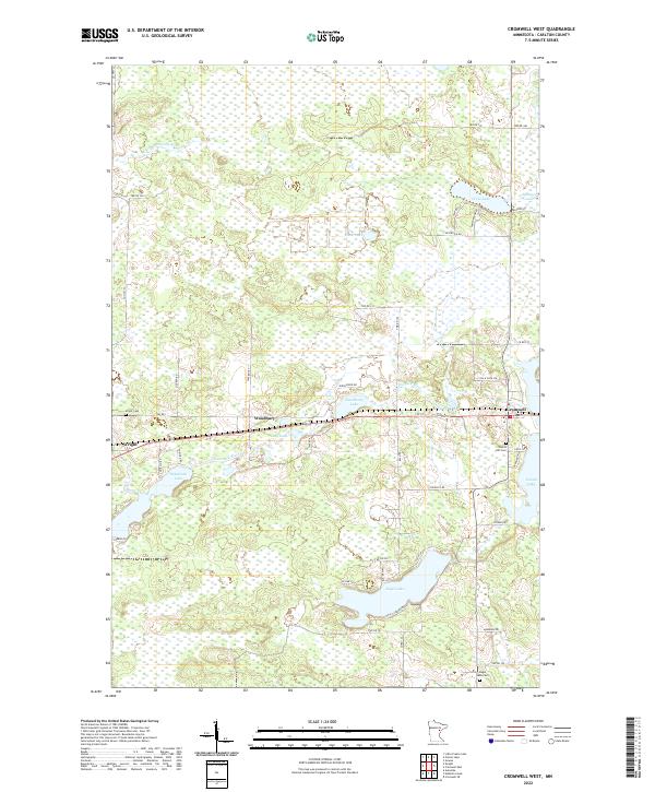
2022 Map of Cromwell West
USGS Topo · Published 2022About this map
Wright and Cromwell anchor this Carlton County landscape, where the Tamarack River and Little Tamarack River wind through a complex network of wetlands and small lakes. The mapping reflects a region defined by its water and woods, with numerous family-named roads like Sjogren Rd and Vodicka Rd providing access to isolated homesteads and recreation areas. The rural character is punctuated by several burial grounds, including Violet Cem near Woodbury and Forest Hill Cem further east, which serve as vital landmarks for local family historians.
Find a feature on this map
56 named features on this map. Tap any name to fly to it.
Don’t see what you’re looking for? This feature index may not catch every label — zoom into the map to look around manually.
Map Details
Editions of this 2022 Cromwell West Map
This is the sole edition of this map. No revisions or reprints were ever made.
Other maps of this area

1953 · Duluth
USGS Topo · 1:250,000

1958 · Duluth
USGS Topo · 1:250,000

1961 · Cromwell
USGS Topo · 1:62,500

1963 · Gowan
USGS Topo · 1:24,000

1963 · Prairie Lake
USGS Topo · 1:24,000

1969 · Automba
USGS Topo · 1:24,000

1970 · Little Prairie Lake
USGS Topo · 1:24,000

1970 · Wright
USGS Topo · 1:24,000

1980 · Duluth
USGS Topo · 1:100,000
1982 · Heikkila Creek
USGS Topo · 1:24,000