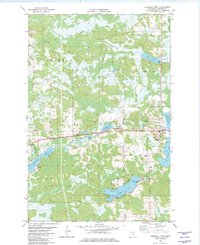
1982 Map of Cromwell West
USGS Topo · Published 1982About this map
The Tamarack River winds through the wetlands and glacial lakes of Carlton County, defining the rural character of this northern landscape. The village of Wright sits near the western edge of the quadrangle, while Cromwell anchors the eastern side, both connected by the Northern Burlington railroad line. The map highlights a deeply traditional rural infrastructure, evidenced by numerous gravel pits and well-established family-named routes such as Lundin Rd and Oestreich Road. Genealogists will find particular value in the documentation of local burial grounds, including Violet Cem and Forest Hill Cem near the town sites, and the more remote Eagle Lake Cem further south. The presence of several Winter Trails underscores the seasonal nature of transit and resource management in this region during the early 1980s.
Find a feature on this map
28 named features on this map. Tap any name to fly to it.
Don’t see what you’re looking for? This feature index may not catch every label — zoom into the map to look around manually.
Map Details
Editions of this 1982 Cromwell West Map
This is the sole edition of this map. No revisions or reprints were ever made.
Other maps of this area

1953 · Duluth
USGS Topo · 1:250,000

1958 · Duluth
USGS Topo · 1:250,000

1961 · Cromwell
USGS Topo · 1:62,500

1963 · Gowan
USGS Topo · 1:24,000

1963 · Prairie Lake
USGS Topo · 1:24,000

1969 · Automba
USGS Topo · 1:24,000

1970 · Little Prairie Lake
USGS Topo · 1:24,000

1970 · Wright
USGS Topo · 1:24,000

1980 · Duluth
USGS Topo · 1:100,000
1982 · Heikkila Creek
USGS Topo · 1:24,000