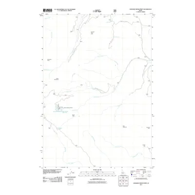
2011 Map of Crooked River Point
USGS Topo · Published 2011About this map
The Cuddy Mountains dominate this 2011 survey, showing a landscape defined by water management and mineral exploration in Washington County. In the southwest, the Cuddy Mine sits near the headwaters of Placer Creek, while the central drainage is anchored by the Hornet Reservoir system. These works include both the Hornet Creek-Upper Dam and the Hornet Creek-Lower Dam, which regulate flows into the Lower Hornet Reservoir.
Find a feature on this map
35 named features on this map. Tap any name to fly to it.
Don’t see what you’re looking for? This feature index may not catch every label — zoom into the map to look around manually.
Map Details
Editions of this 2011 Crooked River Point Map
This is the sole edition of this map. No revisions or reprints were ever made.
Other maps of this area

1955 · Baker
USGS Topo · 1:250,000

1957 · Cambridge
USGS Topo · 1:62,500

1957 · Copperfield
USGS Topo · 1:62,500

1957 · Hornet
USGS Topo · 1:62,500

1957 · Sturgill Peak
USGS Topo · 1:62,500

1959 · Baker
USGS Topo · 1:250,000

1980 · McCall
USGS Topo · 1:100,000

1986 · Peck Mountain
USGS Topo · 1:24,000
1986 · Crooked River Point
USGS Topo · 1:24,000
1986 · Rocky Comfort Flat
USGS Topo · 1:24,000