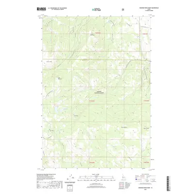
2020 Map of Crooked River Point
USGS Topo · Published 2020About this map
Cuddy Mountains dominate the western horizon of this high-elevation terrain within the Payette National Forest, straddling the border of Adams and Washington counties. The landscape is defined by a series of prominent peaks and ridgelines, including Summers Point, Crooked River Point, and Pyramid Point. Water is central to the area's geography, with the Lower Hornet Reservoir and Rush Lake serving as key landmarks. The drainage network is dense, featuring the Crooked River and numerous creeks such as Goodrich Cr and Hornet Cr. A distinct geological feature known as the Devils Slide sits north of the grassy expanse of Olive Meadows. The presence of Buck Park indicates one of the few named landing points in this heavily forested and deeply carved topography, where Forest Service roads like Nat For Dev Rd 004 provide the primary access through the drainage divides.
Find a feature on this map
46 named features on this map. Tap any name to fly to it.
Don’t see what you’re looking for? This feature index may not catch every label — zoom into the map to look around manually.
Map Details
Editions of this 2020 Crooked River Point Map
This is the sole edition of this map. No revisions or reprints were ever made.
Other maps of this area

1955 · Baker
USGS Topo · 1:250,000

1957 · Cambridge
USGS Topo · 1:62,500

1957 · Copperfield
USGS Topo · 1:62,500

1957 · Hornet
USGS Topo · 1:62,500

1957 · Sturgill Peak
USGS Topo · 1:62,500

1959 · Baker
USGS Topo · 1:250,000

1980 · McCall
USGS Topo · 1:100,000

1986 · Peck Mountain
USGS Topo · 1:24,000
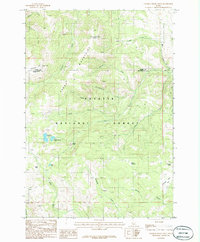
1986 · Crooked River Point
USGS Topo · 1:24,000
1986 · Rocky Comfort Flat
USGS Topo · 1:24,000