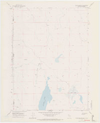
1966 Map of Crooks Meadow
USGS Topo · Published 1969About this map
Crooks Ranch sits at the edge of the high desert terrain where the borders of Modoc County and California and Nevada meet. This mid-1960s survey captures a remote basin defined by significant water features such as Crooks Lake and Holy Lake, which drain through the lush expanses of Crooks Meadow and Holy Valley. The landscape is characterized by a sparse network of jeep roads and a single trail that connects isolated watering points like Big Spring and numerous unnamed seeps. This map illustrates the vital role of persistent water sources in the high-elevation ranching and grazing lands of the Great Basin, providing a detailed record of benchmarks and springs used by those navigating this trans-boundary region.
Find a feature on this map
18 named features on this map. Tap any name to fly to it.
Don’t see what you’re looking for? This feature index may not catch every label — zoom into the map to look around manually.
Map Details
Editions of this 1966 Crooks Meadow Map
2 editions found
Other maps of this area

1886 · Alturas
USGS Topo · 1:250,000

1889 · Long Valley
USGS Topo · 1:250,000

1892 · Alturas
USGS Topo · 1:250,000

1954 · Vya
USGS Topo · 1:250,000

1954 · Alturas
USGS Topo · 1:250,000

1958 · Alturas
USGS Topo · 1:250,000

1958 · Vya
USGS Topo · 1:250,000

1962 · Alturas
USGS Topo · 1:250,000

1962 · Vya
USGS Topo · 1:250,000

1962 · Cedarville
USGS Topo · 1:62,500