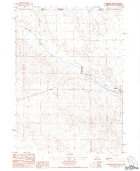
1985 Map of Crookston West
USGS Topo · Published 1985About this map
Crookston serves as the primary hub for this transition zone where the Nebraska Sandhills meet the South Dakota border. The landscape is defined by the winding course of Minnechaduza Creek and Dry Creek, which cut through the high plains. A significant portion of the north is marked by the Rosebud Indian Reservation Boundary, illustrating the intersection of tribal lands and agricultural Nebraska. Modern infrastructure, including a prominent Underground Tel Cable, cuts across the terrain, indicating the evolving utility networks of the mid-1980s. Local industry is represented by a Quarry near the creek, providing a glimpse into the regional extraction economy during this era of rural development.
Find a feature on this map
8 named features on this map. Tap any name to fly to it.
Don’t see what you’re looking for? This feature index may not catch every label — zoom into the map to look around manually.
Map Details
Editions of this 1985 Crookston West Map
This is the sole edition of this map. No revisions or reprints were ever made.
Other maps of this area

1950 · Kilgore
USGS Topo · 1:62,500

1950 · Valentine
USGS Topo · 1:62,500

1955 · Martin
USGS Topo · 1:250,000

1957 · Valentine
USGS Topo · 1:250,000

1958 · Martin
USGS Topo · 1:250,000

1959 · Valentine
USGS Topo · 1:250,000

1969 · St. Francis SW
USGS Topo · 1:24,000

1969 · Olsonville SW
USGS Topo · 1:24,000

1969 · St. Francis SE
USGS Topo · 1:24,000

1982 · Mission
USGS Topo · 1:100,000