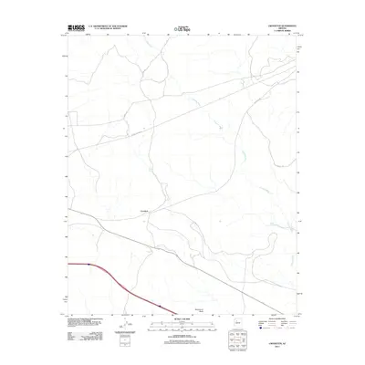
2011 Map of Crookton
USGS Topo · Published 2011About this map
Crookton occupies a central position in this high-desert landscape, where the transit corridors of northern Arizona intersect with a network of rural water infrastructure and service roads. The drainage of Pineveta Wash snakes across the terrain, supported by artificial water sources such as Garrett Tank and Gleed Tank, which are essential features in this arid environment. These landmarks provide clear evidence of the local ranching or land management practices that define the area's utility. To the south, Stud Horse Butte rises as a prominent topographical feature, overlooking a complex grid of thoroughfares including Pine Veta Rd and Forest Service Rd. The presence of these named roads and water tanks reveals how this portion of Yavapai County was organized for access and resource management at the start of the twenty-first century.
Find a feature on this map
10 named features on this map. Tap any name to fly to it.
Don’t see what you’re looking for? This feature index may not catch every label — zoom into the map to look around manually.
Map Details
Editions of this 2011 Crookton Map
This is the sole edition of this map. No revisions or reprints were ever made.
Other maps of this area

1886 · Chino
USGS Topo · 1:250,000

1891 · Chino
USGS Topo · 1:250,000

1947 · Picacho Butte
USGS Topo · 1:62,500

1947 · Turkey Canyon
USGS Topo · 1:62,500

1948 · Williams
USGS Topo · 1:250,000

1948 · Picacho Butte
USGS Topo · 1:63,360

1950 · Turkey Canyon
USGS Topo · 1:62,500

1950 · Picacho Butte
USGS Topo · 1:62,500

1954 · Williams
USGS Topo · 1:250,000

1956 · Williams
USGS Topo · 1:250,000