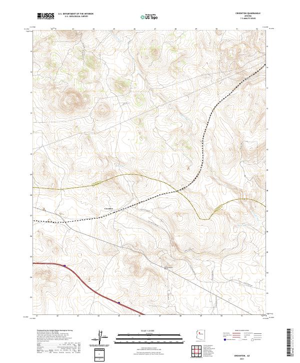
2021 Map of Crookton
USGS Topo · Published 2021About this map
Crookton sits at the heart of this high-desert landscape on the border of Coconino Co Yavapai Co. The geography is defined by the ephemeral flows of Pineveta Wash and several essential water catchments like Garrett Tank and Gleed Tank. Historically, transportation infrastructure has carved through this territory, most notably represented by the Old Santa Fe RR Bed. This decommissioned rail alignment, running parallel to modern transit corridors, offers a clear look at the legacy of southwestern railroad engineering and its role in connecting remote outposts. A network of rural tracks including Fort Bates Rd and Robinson Ranch Rd provides access to the surrounding ranchlands and surveyor-defined townships of the Coconino Plateau.
Find a feature on this map
19 named features on this map. Tap any name to fly to it.
Don’t see what you’re looking for? This feature index may not catch every label — zoom into the map to look around manually.
Map Details
Editions of this 2021 Crookton Map
This is the sole edition of this map. No revisions or reprints were ever made.
Other maps of this area

1886 · Chino
USGS Topo · 1:250,000

1891 · Chino
USGS Topo · 1:250,000

1947 · Picacho Butte
USGS Topo · 1:62,500

1947 · Turkey Canyon
USGS Topo · 1:62,500

1948 · Williams
USGS Topo · 1:250,000

1948 · Picacho Butte
USGS Topo · 1:63,360

1950 · Turkey Canyon
USGS Topo · 1:62,500

1950 · Picacho Butte
USGS Topo · 1:62,500

1954 · Williams
USGS Topo · 1:250,000

1956 · Williams
USGS Topo · 1:250,000