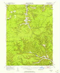
1948 Map of Crosby
USGS Topo · Published 1957About this map
The high plateaus of Norwich and Shippen townships define this mid-century view of north-central Pennsylvania, where the drainage divide separates the waters of Potato Creek from the Driftwood Branch Sinnemahoning Creek. Small, industrial-rooted settlements like Clermont, Colegrove, and Betula dot the narrow valley floors, connected by the rail corridor of the Pennsylvania Railroad. The landscape is heavily marked by its resource-extraction history, evident in the numerous hollows such as Oil Well Hollow and Stone Chimney Hollow that branch off the main watercourses.
Find a feature on this map
121 named features on this map. Tap any name to fly to it.
Don’t see what you’re looking for? This feature index may not catch every label — zoom into the map to look around manually.
Map Details
Editions of this 1948 Crosby Map

Other maps of this area

1924 · Bradford
USGS Topo · 1:62,500

1926 · Bradford
USGS Topo · 1:62,500

1933 · Smethport
USGS Topo · 1:62,500

1934 · Coudersport
USGS Topo · 1:48,000

1935 · Mt. Jewett
USGS Topo · 1:48,000

1937 · Smethport
USGS Topo · 1:62,500

1938 · Coudersport
USGS Topo · 1:62,500

1940 · Mt. Jewett
USGS Topo · 1:62,500

1941 · Benezette
USGS Topo · 1:62,500

1941 · Ridgway
USGS Topo · 1:62,500
Featured Places
- Saint Marys, PA
- Liberty Township, PA
- Norwich Township, PA
- Weber City, Shippen Township
- Crosby, Norwich Township