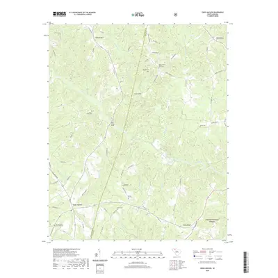
2020 Map of Cross Anchor
USGS Topo · Published 2020About this map
The Tyger River and its numerous tributaries, including Dutchman Creek and Frenchman Creek, define the landscape of this region near the border of Spartanburg and Union Counties. The settlement of Cross Anchor serves as a central hub, connected by a network of rural roads such as Blackstock Road and Buncombe Road. The area is notably dense with sites of genealogical interest, featuring several prominent burial grounds like Belmont Cemetery and the New Hope Baptist Church Graveyard. Evidence of earlier infrastructure remains through labels like Burnt Factory Bridge over the river. To the southeast, the terrain shifts into the protected timberlands of the Sumter National Forest, while Beddington Mountain rises as a local landmark near Dutchman. This survey provides a clear view of the rural Piedmont church-and-cemetery network that continues to anchor these South Carolina communities.
Find a feature on this map
78 named features on this map. Tap any name to fly to it.
Don’t see what you’re looking for? This feature index may not catch every label — zoom into the map to look around manually.
Map Details
Editions of this 2020 Cross Anchor Map
This is the sole edition of this map. No revisions or reprints were ever made.
Other maps of this area

1941 · Spartanburg
USGS Topo · 1:250,000

1947 · Spartanburg
USGS Topo · 1:62,500

1949 · Spartanburg
USGS Topo · 1:62,500

1953 · Spartanburg
USGS Topo · 1:250,000

1960 · Spartanburg
USGS Topo · 1:250,000

1963 · Spartanburg
USGS Topo · 1:250,000

1964 · Spartanburg
USGS Topo · 1:250,000

1969 · Cross Anchor
USGS Topo · 1:24,000

1969 · Ora
USGS Topo · 1:24,000
1969 · Enoree
USGS Topo · 1:24,000