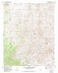
1972 Map of Cross Mountain
USGS Topo · Published 1994About this map
Brostman Spring and Schoolhouse Well indicate the critical importance of water management in this arid section of Kern County during the early 1970s. The landscape is defined by the deep incisions of Jawbone Canyon and Cottonwood Creek, which separate prominent elevations like Cross Mountain, White Mountain, and Toms Hill. The survey reveals a history of resource extraction, particularly in the southeast near Antimony Flat, where the Amalia Mine is located alongside various unnamed Mines and a Prospect. Human activity in the area is largely facilitated by a network of 4wd tracks that navigate the complex topography, connecting remote points such as Hoffman Summit to the canyon floors. This map documents a transition in land use, where mining interests and cattle fencing, marked by numerous red dashed lines, coexist with the natural drainage systems of Little Jawbone Canyon and several unnamed Springs.
Find a feature on this map
10 named features on this map. Tap any name to fly to it.
Don’t see what you’re looking for? This feature index may not catch every label — zoom into the map to look around manually.
Map Details
Editions of this 1972 Cross Mountain Map
2 editions found
Other maps of this area

1915 · Mojave
USGS Topo · 1:125,000

1943 · Tehachapi
USGS Topo · 1:62,500

1943 · Cross Mountain
USGS Topo · 1:62,500

1943 · Emerald Mtn
USGS Topo · 1:62,500

1943 · Mojave
USGS Topo · 1:62,500

1948 · Bakersfield
USGS Topo · 1:250,000

1955 · Bakersfield
USGS Topo · 1:250,000

1956 · Bakersfield
USGS Topo · 1:250,000
1956 · Mojave
USGS Topo · 1:62,500

1960 · Bakersfield
USGS Topo · 1:250,000