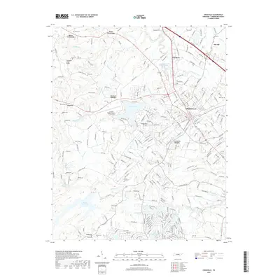
2019 Map of Crossville
USGS Topo · Published 2019About this map
Crossville serves as the central hub of this modern survey, situated atop the Cumberland Plateau at a prominent topographic division. The Tennessee Valley Divide snakes through the western portion of the map, separating drainage that feeds the Obed River and its many tributaries, such as Wolfpen Br and Walker Br, from other watersheds. This area of Tennessee is characterized by its numerous small crossroads settlements and family burial grounds, including Baker Crossroads, Dykes Crossroads, and the Lowery Stand Cem. To the south and west of the city, the landscape is punctuated by substantial water bodies like Lake Holiday, Meadow Park Lake, and Dorton Lake. The aviation history of the region is anchored by the Crossville Memorial Airport-Whitson Field, while residential developments like Volunteer Heights and Woodlawn show the modern footprint of the county seat.
Find a feature on this map
56 named features on this map. Tap any name to fly to it.
Don’t see what you’re looking for? This feature index may not catch every label — zoom into the map to look around manually.
Map Details
Editions of this 2019 Crossville Map
This is the sole edition of this map. No revisions or reprints were ever made.
Other maps of this area

1887 · Kingston
USGS Topo · 1:125,000

1891 · Kingston
USGS Topo · 1:125,000

1892 · Pikeville
USGS Topo · 1:125,000

1893 · Kingston
USGS Topo · 1:125,000

1895 · Wartburg
USGS Topo · 1:125,000

1895 · Pikeville
USGS Topo · 1:125,000

1896 · Wartburg
USGS Topo · 1:125,000

1897 · Standingstone
USGS Topo · 1:125,000

1898 · Standingstone
USGS Topo · 1:125,000

1912 · Crossville
USGS Topo · 1:62,500