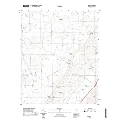
2020 Map of Crossville
USGS Topo · Published 2020About this map
Sand Mountain dominates the western half of this DeKalb County landscape, where the plateau surface supports rural communities like Crossville and Skirum. The terrain shifts dramatically at the Tennessee Valley Divide, dropping through gaps such as Nicholson Gap into the valley floors of Big Wills Valley. This transition from the flat-topped mountain to the ridge-and-valley province is marked by a series of springs and creeks, including Tidmore Spring and Nunn Spring, which feed the drainages of Big Wills Creek.
Find a feature on this map
66 named features on this map. Tap any name to fly to it.
Don’t see what you’re looking for? This feature index may not catch every label — zoom into the map to look around manually.
Map Details
Editions of this 2020 Crossville Map
This is the sole edition of this map. No revisions or reprints were ever made.
Other maps of this area

1885 · Gadsden
USGS Topo · 1:125,000

1888 · Gadsden
USGS Topo · 1:125,000

1892 · Gadsden
USGS Topo · 1:125,000

1893 · Fort Payne
USGS Topo · 1:125,000

1895 · Gadsden
USGS Topo · 1:125,000

1898 · Fort Payne
USGS Topo · 1:125,000

1900 · Fort Payne
USGS Topo · 1:125,000

1903 · Gadsden
USGS Topo · 1:125,000

1936 · Painter
USGS Topo · 1:24,000

1936 · Crossville
USGS Topo · 1:24,000