
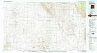
1979 Map of Crow Flats
USGS Topo · Published 1979About this map
Otero Mesa and the expansive desert basins of the Tularosa Valley dominate this late-1970s survey along the New Mexico and Texas border. The landscape is defined by vast ranching tracts and military activity, with much of the southwestern quadrant occupied by the Fort Bliss Military Reservation (McGregor Range). Significant infrastructure for livestock and light aircraft is scattered across the arid terrain, including the Old Wright Place, Tanner Ranch, and the Templeton Ranch Landing Strip.
Find a feature on this map
40 named features on this map. Tap any name to fly to it.
Don’t see what you’re looking for? This feature index may not catch every label — zoom into the map to look around manually.
Map Details
Editions of this 1979 Crow Flats Map
2 editions found
Other maps of this area

1896 · El Paso
USGS Topo · 1:125,000

1903 · Cerro Alto
USGS Topo · 1:125,000

1908 · El Paso
USGS Topo · 1:125,000

1916 · Point Of Sands
USGS Topo · 1:125,000

1933 · Guadalupe Peak
USGS Topo · 1:48,000

1935 · El Paso Gap
USGS Topo · 1:62,500

1936 · El Paso Gap
USGS Topo · 1:48,000

1939 · Heuco Tanks
USGS Topo · 1:62,500

1940 · Heuco Tanks
USGS Topo · 1:62,500

1940 · El Paso Gap
USGS Topo · 1:62,500