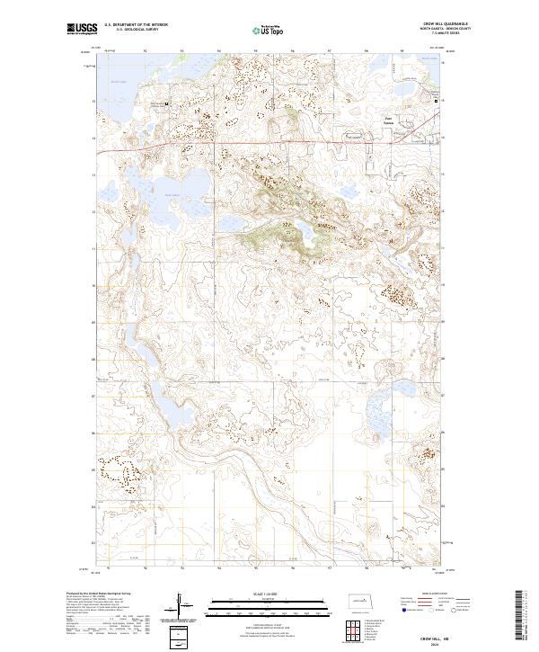
2024 Map of Crow Hill
USGS Topo · Published 2024About this map
Fort Totten and its residential developments, including W Addition and High Meadows, anchor the northeastern corner of this landscape along the southern shores of Devils Lake. The terrain is defined by a dense network of prairie potholes and wetlands, much of which is conserved within the Benson County Waterfowl Production Area and the Sullys Hill National Game Preserve. These protected areas highlight the region's importance as a migratory corridor and habitat for local wildlife.
Find a feature on this map
33 named features on this map. Tap any name to fly to it.
Don’t see what you’re looking for? This feature index may not catch every label — zoom into the map to look around manually.
Map Details
Editions of this 2024 Crow Hill Map
This is the sole edition of this map. No revisions or reprints were ever made.
Other maps of this area

1928 · Tokio
USGS Topo · 1:62,500

1931 · Oberon
USGS Topo · 1:62,500

1931 · Tokio
USGS Topo · 1:62,500

1931 · Devils Lake
USGS Topo · 1:62,500

1932 · Grahams Island
USGS Topo · 1:62,500

1950 · Oberon SW
USGS Topo · 1:24,000

1950 · Sheyenne
USGS Topo · 1:24,000
1950 · Tokio SW
USGS Topo · 1:24,000

1950 · Grahams Island
USGS Topo · 1:62,500

1950 · Devils Lake
USGS Topo · 1:62,500
Featured Places
- Crow Hill District, ND
- Fort Totten, Fort Totten District
- Fort Totten District, ND
- Benson County, ND
- United States