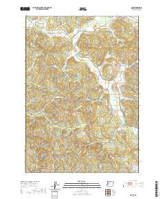
2020 Map of Crow
USGS Topo · Published 2020About this map
The unincorporated community of Crow serves as a focal point in this portion of Lane County, where the lowlands of Coyote Cr meet the rising foothills of the Coast Range. Long-established family names are preserved throughout the landscape in the form of small burial grounds, including Gates Cem, Liles Cem, Jenkins Cem, and McCulloch Cem. These sites, often positioned on higher ground above the drainages, offer significant data for genealogists tracing early settlers of the Willamette Valley’s western edge. The drainage patterns of Wolf Cr and Battle Cr define the local topography, feeding into reservoirs such as Smith Reservoir and Ford Farms Reservoir. A network of Bureau of Land Management roads, such as BLM RD 19-5-21.4, provides access to the higher elevations around Wolf Point, reflecting the region's ongoing involvement with timber management and public land use.
Find a feature on this map
64 named features on this map. Tap any name to fly to it.
Don’t see what you’re looking for? This feature index may not catch every label — zoom into the map to look around manually.
Map Details
Editions of this 2020 Crow Map
This is the sole edition of this map. No revisions or reprints were ever made.
Other maps of this area

1909 · Elmira
USGS Topo · 1:62,500

1910 · Eugene
USGS Topo · 1:62,500

1921 · Cottage Grove
USGS Topo · 1:62,500

1922 · Elmira
USGS Topo · 1:62,500

1940 · Eugene
USGS Topo · 1:62,500

1942 · Elmira
USGS Topo · 1:62,500

1942 · Crow
USGS Topo · 1:62,500

1945 · Crow
USGS Topo · 1:62,500

1946 · Eugene
USGS Topo · 1:62,500

1949 · Eugene
USGS Topo · 1:62,500