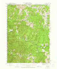
1942 Map of Crow
USGS Topo · Published 1965About this map
The settlement of Crow serves as a focal point for this 1940s landscape, where the upper Siuslaw River and its numerous tributaries like Wildcat Creek and Wolf Creek define the drainage patterns of Lane County. The map captures a moment of early development, showing localized rural hubs such as Wolf Creek Store and Gillespie Corners. Education and community life are marked by small rural schoolhouses, including Hadleyville Sch and Lowe Cedar Sch, which were often the cornerstone of family life in these valleys.
Find a feature on this map
51 named features on this map. Tap any name to fly to it.
Don’t see what you’re looking for? This feature index may not catch every label — zoom into the map to look around manually.
Map Details
Editions of this 1942 Crow Map
2 editions found
Other maps of this area

1909 · Elmira
USGS Topo · 1:62,500

1910 · Eugene
USGS Topo · 1:62,500

1921 · Cottage Grove
USGS Topo · 1:62,500

1922 · Elmira
USGS Topo · 1:62,500

1940 · Eugene
USGS Topo · 1:62,500

1941 · Blachly
USGS Topo · 1:62,500

1942 · Elmira
USGS Topo · 1:62,500

1942 · Blachly
USGS Topo · 1:62,500

1942 · Crow
USGS Topo · 1:62,500

1942 · Roman Nose Mtn
USGS Topo · 1:62,500