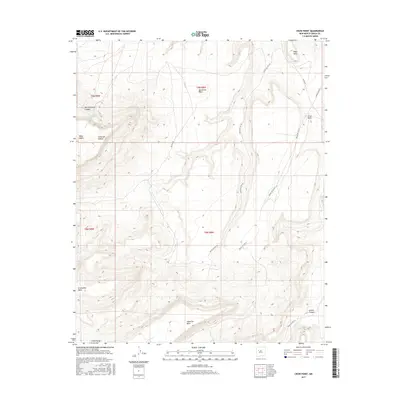
2017 Map of Crow Point
USGS Topo · Published 2017About this map
Cebollita Mesa dominates the southern landscape of this 2017 high-desert survey in Cibola County, where the topography transitions between expansive plateaus and deeply carved drainages. The area is characterized by a series of prominent mesas, including Sandstone Mesa and Koya Mesa, separated by significant topographic breaks like Cañon de Conejo and North Lumber Canyon. These landforms dictate the passage of modern and traditional routes, such as Indian Svc Rte 292 and BIA Dirt Rd, which wind through the complex terrain. Water sources are sparse but critical markers in this environment, with Mesa Negra Spring and Sky Spring providing rare points of relief in the arid uplands. To the east, the eponymous Crow Point stands as a distinct landmark overlooking the lower elevations of the Acoma Cr drainage and the northern reaches of Acoma Canyon.
Find a feature on this map
22 named features on this map. Tap any name to fly to it.
Don’t see what you’re looking for? This feature index may not catch every label — zoom into the map to look around manually.
Map Details
Editions of this 2017 Crow Point Map
This is the sole edition of this map. No revisions or reprints were ever made.
Other maps of this area

1883 · Mt. Taylor
USGS Topo · 1:250,000

1886 · Mt. Taylor
USGS Topo · 1:250,000

1892 · Mt. Taylor
USGS Topo · 1:250,000

1899 · Mt. Taylor
USGS Topo · 1:250,000

1917 · Broom Mountain
USGS Topo · 1:125,000

1954 · Socorro
USGS Topo · 1:250,000

1957 · Grants SE
USGS Topo · 1:24,000

1957 · Mc Cartys
USGS Topo · 1:24,000

1957 · Cubero
USGS Topo · 1:24,000

1958 · Socorro
USGS Topo · 1:250,000