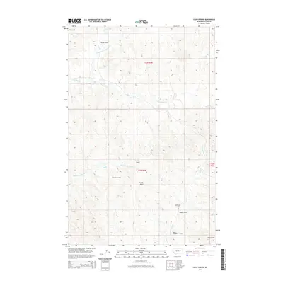
2014 Map of Crow Springs
USGS Topo · Published 2014About this map
Bonhoff Butte rises as a prominent landmark in this section of McCone County, anchoring a landscape defined by an intricate network of drainages and seasonal water sources. The topography is deeply incised by numerous coulees, including Heagy Coulee, Anderson Coulee, and Roald Coulee, which channel runoff toward major stream systems like S Fork Rock Cr and N Fork McGuire Cr.
Find a feature on this map
19 named features on this map. Tap any name to fly to it.
Don’t see what you’re looking for? This feature index may not catch every label — zoom into the map to look around manually.
Map Details
Editions of this 2014 Crow Springs Map
This is the sole edition of this map. No revisions or reprints were ever made.
Other maps of this area

1954 · Jordan
USGS Topo · 1:250,000

1954 · Glendive
USGS Topo · 1:250,000

1956 · Jordan
USGS Topo · 1:250,000

1957 · Glendive
USGS Topo · 1:250,000

1958 · Jordan
USGS Topo · 1:250,000

1958 · Glendive
USGS Topo · 1:250,000

1964 · Jordan
USGS Topo · 1:250,000

1973 · Crow Springs
USGS Topo · 1:24,000
1973 · Willis Buttes
USGS Topo · 1:24,000
1973 · Sand Arroyo
USGS Topo · 1:24,000