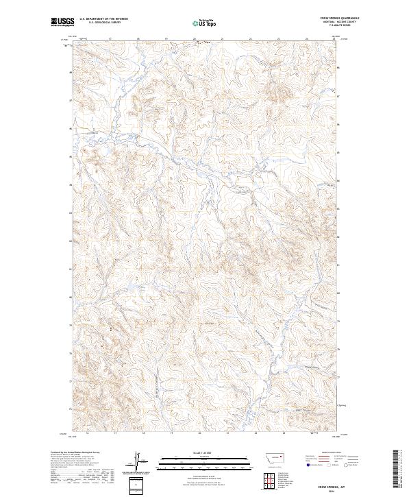
2024 Map of Crow Springs
USGS Topo · Published 2024About this map
Crow Spring and Solhaug Spring serve as vital water sources in this McCone County landscape, where the high-plains terrain is deeply dissected by a network of drainage systems. The northern half of the map is defined by the South Fork Rock Creek and its many tributaries, while the southern reaches are dominated by significant coulees, including Antelope Coulee and Anderson Coulee. These features imply a landscape historically shaped by livestock ranching and the necessity of managing reliable water points across open range. Notable landmarks such as Bonhoff Butte provide orientation points amidst the complex topography of the North Fork McGuire Creek drainage. The map provides a detailed view of the section lines and township boundaries, including t23n r44e, that still govern land ownership in this rural Montana region.
Find a feature on this map
18 named features on this map. Tap any name to fly to it.
Don’t see what you’re looking for? This feature index may not catch every label — zoom into the map to look around manually.
Map Details
Editions of this 2024 Crow Springs Map
This is the sole edition of this map. No revisions or reprints were ever made.
Other maps of this area

1954 · Jordan
USGS Topo · 1:250,000

1954 · Glendive
USGS Topo · 1:250,000

1956 · Jordan
USGS Topo · 1:250,000

1957 · Glendive
USGS Topo · 1:250,000

1958 · Jordan
USGS Topo · 1:250,000

1958 · Glendive
USGS Topo · 1:250,000

1964 · Jordan
USGS Topo · 1:250,000

1973 · Crow Springs
USGS Topo · 1:24,000
1973 · Willis Buttes
USGS Topo · 1:24,000
1973 · Sand Arroyo
USGS Topo · 1:24,000