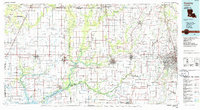
1985 Map of Crowley
USGS Topo · Published 1986About this map
The Mermentau River and its intricate drainage network, including Bayou Nezpique and Bayou des Cannes, dominate the agricultural heartland of southern Louisiana. This mid-1980s survey captures the region's complex water-dependent geography, from the Lacassine National Wildlife Refuge in the southwest to the urban expansion around Lafayette in the east. The landscape is defined by the rigid grid of rice fields and crawfish ponds, interlaced with the Southern Pacific Railroad and Missouri Pacific Railroad lines that historically connected these prairie towns to wider markets. Significant infrastructure like the Gulf Intracoastal Waterway and Le Gros Memorial Airport highlight the 20th-century industrial and aviation developments that reshaped the economy of Acadia Parish and its neighbors. Smaller settlements like Church Point, Iota, and Gueydan serve as local nodes within this vast system of bayous and parish-spanning highways.
Find a feature on this map
185 named features on this map. Tap any name to fly to it.
Don’t see what you’re looking for? This feature index may not catch every label — zoom into the map to look around manually.
Map Details
Editions of this 1985 Crowley Map
2 editions found
Other maps of this area

1932 · Lake Charles NE
USGS Topo · 1:31,680

1932 · Abbeville NE
USGS Topo · 1:31,680

1932 · Abbeville NW
USGS Topo · 1:31,680

1932 · Lake Charles SE
USGS Topo · 1:31,680

1934 · Duson
USGS Topo · 1:31,680

1934 · Lake Misere
USGS Topo · 1:24,000

1934 · Boudreaux Lake
USGS Topo · 1:24,000

1934 · Latania Lake
USGS Topo · 1:24,000

1935 · Branch
USGS Topo · 1:31,680

1935 · Lake Misere
USGS Topo · 1:31,680