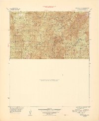
1948 Map of Crown King
USGS Topo · Published 1948About this map
Crown King Mine and dozens of associated workings dominate this mid-century survey of the high Bradshaw Mountains. The map serves as a dense inventory of hard-rock mining activity, featuring the Gladiator Mines, Lincoln Mine, and Tiber Mine clustered around the settlement of Crown King. These operations are connected by the Senator Hwy, winding through high elevations near Towers Mtn and the Crown King Ranger Sta. To the west, the landscape transitions into the drainage basins of Minnehaha Creek and Cherry Creek, where smaller outposts like Minnehaha and Paxton Place once supported local prospectors. The presence of the Horsethief Basin Recreation Area and various Forest Camps indicates the early 20th-century shift toward forest management and public recreation within the Prescott National Forest, even as active shafts like the Pacific Mine remained prominent features on the terrain.
Find a feature on this map
65 named features on this map. Tap any name to fly to it.
Don’t see what you’re looking for? This feature index may not catch every label — zoom into the map to look around manually.
Map Details
Editions of this 1948 Crown King Map
2 editions found

Other maps of this area

1887 · Prescott
USGS Topo · 1:250,000

1892 · Prescott
USGS Topo · 1:250,000

1903 · Bradshaw Mountains
USGS Topo · 1:125,000

1903 · Congress
USGS Topo · 1:125,000

1904 · Congress
USGS Topo · 1:125,000

1947 · Crown King
USGS Topo · 1:62,500

1947 · Bumblebee
USGS Topo · 1:62,500

1947 · Mayer
USGS Topo · 1:62,500

1947 · Mt. Union
USGS Topo · 1:62,500

1947 · Kirkland
USGS Topo · 1:62,500