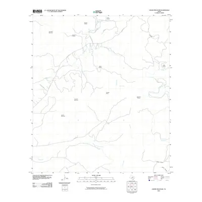
2010 Map of Crown Mountain
USGS Topo · Published 2010About this map
Crown Mountain and Housetop Mountain anchor this canyon-carved landscape in Real County, where the headwaters of several drainage systems converge. The terrain is defined by a series of named hollows, such as Orchard Hollow and Seed Tick Hollow, which feed into the primary watercourses of Camp Wood Creek and the Dry Frio River. The drainage pattern is particularly evident where South Camp Wood Creek and Lee Creek navigate the base of prominent rises like Caprock Mountain. Local infrastructure is sparse, primarily consisting of corridors like Ranch Rd 337 and Phillips Rd that follow the natural contours of the hills. Key water sources, including Evans Spring, Russell Spring, and Trough Springs, mark vital points in this arid topography, highlighting the importance of reliable water in the Texas Hill Country.
Find a feature on this map
30 named features on this map. Tap any name to fly to it.
Don’t see what you’re looking for? This feature index may not catch every label — zoom into the map to look around manually.
Map Details
Editions of this 2010 Crown Mountain Map
This is the sole edition of this map. No revisions or reprints were ever made.
Other maps of this area

1893 · Nueces
USGS Topo · 1:125,000

1896 · Nueces
USGS Topo · 1:125,000

1944 · Barksdale
USGS Topo · 1:62,500

1947 · Hackberry
USGS Topo · 1:62,500

1954 · San Antonio
USGS Topo · 1:250,000

1957 · San Antonio
USGS Topo · 1:250,000

1957 · York Hollow
USGS Topo · 1:62,500

1958 · Del Rio
USGS Topo · 1:250,000

1964 · Del Rio
USGS Topo · 1:250,000
1971 · Leakey
USGS Topo · 1:24,000