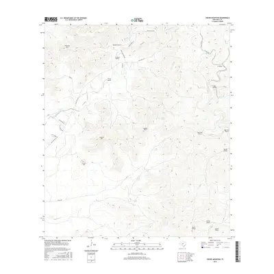
2016 Map of Crown Mountain
USGS Topo · Published 2016About this map
Crown Mtn and Caprock Mtn anchor this high-elevation terrain in Real County, where the landscape is defined by deep draws and water-carved hollows. In the northeast, the Dry Frio River winds through narrow valleys near Trough Springs, while the western portion of the map is dominated by the headwaters of Camp Wood Cr. The naming conventions throughout these hills reflect a history of local families and natural landmarks, seen in features like Hatley Hollow, Orchard Hollow, and the aptly named Bee Cave Hollow. Road networks such as Ranch Rd 337 W and Phillips Rd follow the natural contours of the land, providing access to these remote ranching areas. Critical water sources like Eads Springs and Evans Spring appear as vital points in an otherwise arid landscape of limestone peaks and brush-covered knobs like Gobbler Knob.
Find a feature on this map
39 named features on this map. Tap any name to fly to it.
Don’t see what you’re looking for? This feature index may not catch every label — zoom into the map to look around manually.
Map Details
Editions of this 2016 Crown Mountain Map
This is the sole edition of this map. No revisions or reprints were ever made.
Other maps of this area

1893 · Nueces
USGS Topo · 1:125,000

1896 · Nueces
USGS Topo · 1:125,000

1944 · Barksdale
USGS Topo · 1:62,500

1947 · Hackberry
USGS Topo · 1:62,500

1954 · San Antonio
USGS Topo · 1:250,000

1957 · San Antonio
USGS Topo · 1:250,000

1957 · York Hollow
USGS Topo · 1:62,500

1958 · Del Rio
USGS Topo · 1:250,000

1964 · Del Rio
USGS Topo · 1:250,000
1971 · Leakey
USGS Topo · 1:24,000