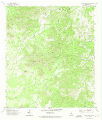
1971 Map of Crown Mountain
USGS Topo · Published 1974About this map
High-altitude ranching and rugged topography define this section of Real County in the early 1970s. The landscape is punctuated by prominent peaks like Crown Mountain and Caprock Mountain, while a network of deeply etched drainages including Sycamore Creek and Wood Creek dictate the local movement. This era shows the land utilized for remote operations, evidenced by the Landing Strip situated on a high plateau and various scattered wells and tanks used for livestock or resource management.
Find a feature on this map
27 named features on this map. Tap any name to fly to it.
Don’t see what you’re looking for? This feature index may not catch every label — zoom into the map to look around manually.
Map Details
Editions of this 1971 Crown Mountain Map
This is the sole edition of this map. No revisions or reprints were ever made.
Other maps of this area

1893 · Nueces
USGS Topo · 1:125,000

1896 · Nueces
USGS Topo · 1:125,000

1944 · Barksdale
USGS Topo · 1:62,500

1947 · Hackberry
USGS Topo · 1:62,500

1954 · San Antonio
USGS Topo · 1:250,000

1957 · San Antonio
USGS Topo · 1:250,000

1957 · York Hollow
USGS Topo · 1:62,500

1958 · Del Rio
USGS Topo · 1:250,000

1964 · Del Rio
USGS Topo · 1:250,000
1971 · Leakey
USGS Topo · 1:24,000