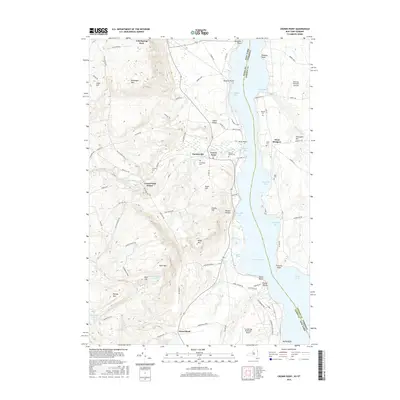
2016 Map of Crown Point
USGS Topo · Published 2016About this map
Lake Champlain serves as the focal point for this borderlands survey, where the waters divide New York and Vermont. The landscape is defined by the steep elevation of Bulwagga Mtn and Buck Mtn to the west, contrasted by the lower, fertile land of West Bridport on the eastern shore. Smaller settlements like Factoryville, Crown Point Center, and Street Road are scattered across the terrain, connected by a network of local routes including Breed Hill Rd and White Church Rd.
Find a feature on this map
97 named features on this map. Tap any name to fly to it.
Don’t see what you’re looking for? This feature index may not catch every label — zoom into the map to look around manually.
Map Details
Editions of this 2016 Crown Point Map
This is the sole edition of this map. No revisions or reprints were ever made.
Other maps of this area

1894 · Elizabethtown
USGS Topo · 1:62,500

1894 · Port Henry
USGS Topo · 1:62,500

1894 · Ticonderoga
USGS Topo · 1:62,500

1895 · Elizabethtown
USGS Topo · 1:62,500

1895 · Paradox Lake
USGS Topo · 1:62,500

1896 · Ticonderoga
USGS Topo · 1:62,500

1897 · Paradox Lake
USGS Topo · 1:62,500

1898 · Port Henry
USGS Topo · 1:62,500

1901 · Elizabethtown
USGS Topo · 1:62,500

1902 · Ticonderoga
USGS Topo · 1:62,500