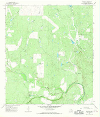
1965 Map of Crowther
USGS Topo · Published 1968About this map
The Frio River winds through the southern portion of this landscape, meeting the waters of San Miguel Creek in a region defined by its water management and resource extraction. At the center of this 1960s survey lies the settlement of Crowther, positioned near an Old Railroad Grade that speaks to the area's earlier transport infrastructure. The terrain is marked by numerous man-made water features essential for ranching in this Texas environment, including the curiously named Pot of Gold Tank, Van Meter Tank, and Persimmon Hollow Tank.
Find a feature on this map
26 named features on this map. Tap any name to fly to it.
Don’t see what you’re looking for? This feature index may not catch every label — zoom into the map to look around manually.
Map Details
Editions of this 1965 Crowther Map
2 editions found
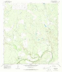
Other maps of this area

1920 · Mikeska
USGS Topo · 1:125,000

1925 · Simmons No. 1
USGS Topo · 1:48,000

1925 · Tilden No. 1
USGS Topo · 1:48,000

1925 · Crowther No. 3
USGS Topo · 1:48,000

1925 · Simmons No. 2
USGS Topo · 1:48,000

1929 · Simmons
USGS Topo · 1:62,500

1930 · Tilden
USGS Topo · 1:62,500

1930 · Whitsett
USGS Topo · 1:62,500

1942 · Tilden
USGS Topo · 1:62,500

1942 · Whitsett
USGS Topo · 1:62,500