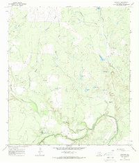
1965 Map of Crowther
USGS Topo · Published 1968About this map
Crowther serves as the primary settlement hub in this South Texas landscape, situated near the intersection of several notable watercourses and industrial sites. The terrain is defined by the winding course of the Frio River, which joins with San Miguel Creek in the southern portion of the quadrangle. This area was a site of active resource extraction during the mid-1960s, evidenced by numerous Oil Well and Drill Hole locations scattered across the brush country.
Find a feature on this map
26 named features on this map. Tap any name to fly to it.
Don’t see what you’re looking for? This feature index may not catch every label — zoom into the map to look around manually.
Map Details
Editions of this 1965 Crowther Map
2 editions found
Other maps of this area

1920 · Mikeska
USGS Topo · 1:125,000

1925 · Simmons No. 1
USGS Topo · 1:48,000

1925 · Tilden No. 1
USGS Topo · 1:48,000

1925 · Crowther No. 3
USGS Topo · 1:48,000

1925 · Simmons No. 2
USGS Topo · 1:48,000

1929 · Simmons
USGS Topo · 1:62,500

1930 · Tilden
USGS Topo · 1:62,500

1930 · Whitsett
USGS Topo · 1:62,500

1942 · Tilden
USGS Topo · 1:62,500

1942 · Whitsett
USGS Topo · 1:62,500