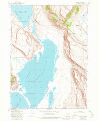
1967 Map of Crump Lake
USGS Topo · Published 1980About this map
Hart Mountain National Antelope Refuge dominates the eastern high ground of this landscape, where steep escarpments drop sharply into the Warner Valley. This 1967 field-checked survey captures the intricate hydrology of the Warner Lakes system, showing the connection between Hart Lake and Crump Lake through a marshy passage known as the Narrows.
Find a feature on this map
19 named features on this map. Tap any name to fly to it.
Don’t see what you’re looking for? This feature index may not catch every label — zoom into the map to look around manually.
Map Details
Editions of this 1967 Crump Lake Map
3 editions found
Other maps of this area

1955 · Adel
USGS Topo · 1:250,000

1957 · Adel
USGS Topo · 1:250,000

1958 · Adel
USGS Topo · 1:250,000

1962 · Adel
USGS Topo · 1:250,000

1967 · Jacobs Reservoir
USGS Topo · 1:24,000

1967 · Plush
USGS Topo · 1:24,000

1967 · Priday Reservoir
USGS Topo · 1:24,000

1967 · Hart Lake
USGS Topo · 1:24,000

1967 · Warner Peak
USGS Topo · 1:24,000

1967 · Crump Lake
USGS Topo · 1:24,000