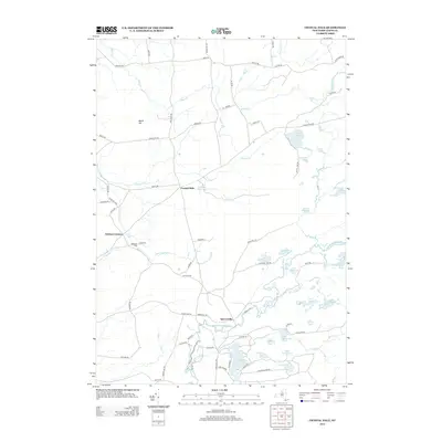
2013 Map of Crystal Dale
USGS Topo · Published 2013About this map
Crystal Dale and the surrounding Lewis County landscape are defined by an intricate network of glacial lakes and small settlements in the early 21st century. The map reveals a cluster of interior water bodies, including Crystal Lake, Chase Lake, and the winding path of the Independence River. To the west, Petries Corners and Sperryville anchor a network of local roads such as Kirch Rd and Auctor Rd. The historical footprint of the region is evident in features like Erie Canal Rd, suggesting the enduring influence of 19th-century infrastructure on modern property lines. Genealogists may find value in the location of Wetmore Cem near the banks of Harvey Cr. The terrain rises at Beech Hill, while the Lowville Reservoir and Beach Millpond indicate the localized management of water resources for the neighboring communities.
Find a feature on this map
79 named features on this map. Tap any name to fly to it.
Don’t see what you’re looking for? This feature index may not catch every label — zoom into the map to look around manually.
Map Details
Editions of this 2013 Crystal Dale Map
This is the sole edition of this map. No revisions or reprints were ever made.
Other maps of this area

1905 · Port Leyden
USGS Topo · 1:62,500

1907 · Port Leyden
USGS Topo · 1:62,500

1911 · Lowville
USGS Topo · 1:62,500

1912 · Number Four
USGS Topo · 1:62,500

1912 · Mc Keever
USGS Topo · 1:62,500

1913 · Lowville
USGS Topo · 1:62,500

1915 · Number Four
USGS Topo · 1:62,500

1940 · Port Leyden
USGS Topo · 1:62,500

1950 · Utica
USGS Topo · 1:250,000

1957 · Utica
USGS Topo · 1:250,000