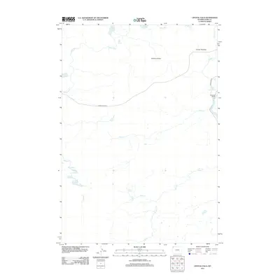
2012 Map of Crystal Falls
USGS Topo · Published 2012About this map
Crystal Falls and the Upper Falls of the Yellowstone River define the eastern edge of this landscape, where the Yellowstone River cuts through the high plateau. The convergence of hydrogeological features is evident in the numerous thermal and freshwater sources, including Violet Springs, Terrace Hot Spring, and Wolf Lake Springs. These features suggest the active geothermal nature of the Solfatara Plateau region. Transportation is anchored by the Grand Loop Rd and Norris Canyon Rd, which intersect near the Chittenden Bridge. The interior is defined by a dense network of drainage systems, such as Otter Cr, Alum Cr, and the Gibbon River, which connect alpine bodies like Grebe Lake and the Cygnet Lakes. This survey provides a precise view of the park's central wilderness as it was managed and mapped in the early twenty-first century.
Find a feature on this map
22 named features on this map. Tap any name to fly to it.
Don’t see what you’re looking for? This feature index may not catch every label — zoom into the map to look around manually.
Map Details
Editions of this 2012 Crystal Falls Map
This is the sole edition of this map. No revisions or reprints were ever made.
Other maps of this area

1885 · Gallatin
USGS Topo · 1:125,000

1885 · Gallatin
USGS Topo · 1:125,000

1886 · Canyon
USGS Topo · 1:125,000

1895 · Canyon
USGS Topo · 1:125,000

1896 · Canyon
USGS Topo · 1:125,000

1901 · Canyon
USGS Topo · 1:125,000

1901 · Gallatin
USGS Topo · 1:125,000

1907 · Canyon
USGS Topo · 1:125,000

1908 · Gallatin
USGS Topo · 1:125,000

1911 · Gallatin
USGS Topo · 1:125,000