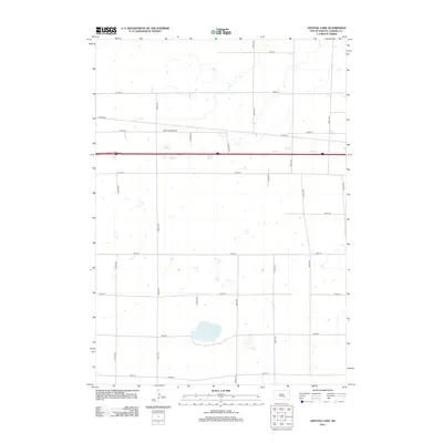
2012 Map of Crystal Lake
USGS Topo · Published 2012About this map
Crystal Lake serves as a central landmark in this rural Aurora County landscape, situated amidst a precise grid of sectional roads. The 2012 topography shows a predominantly agricultural region defined by expansive sections and sparse development. A notable aviation feature, the Genes Spray Strip, highlights the importance of aerial application for the local farming economy. Modern transit is represented by the corridor of Interstate 90, which cuts through the northern half of the township, contrasting with the local network of numbered roads like County Highway 34 and 382nd Avenue. The terrain is characterized by subtle drainage patterns and seasonal wetlands that surround the namesake lake, providing a clear view of the water resources managed within this high-plains environment.
Find a feature on this map
20 named features on this map. Tap any name to fly to it.
Don’t see what you’re looking for? This feature index may not catch every label — zoom into the map to look around manually.
Map Details
Editions of this 2012 Crystal Lake Map
This is the sole edition of this map. No revisions or reprints were ever made.
Other maps of this area

1899 · Mitchell
USGS Topo · 1:125,000

1942 · Crow Lake
USGS Topo · 1:62,500

1955 · Mitchell
USGS Topo · 1:250,000

1959 · Mitchell
USGS Topo · 1:250,000

1979 · Laffey Lake
USGS Topo · 1:24,000

1979 · Crystal Lake
USGS Topo · 1:24,000

1979 · White Lake
USGS Topo · 1:24,000

1979 · Aurora Center
USGS Topo · 1:24,000

1979 · Storla SW
USGS Topo · 1:24,000

1980 · Stickney
USGS Topo · 1:24,000
Featured Places
- Eureka Township, SD
- Crystal Lake Township, SD
- Plankinton Township, SD
- Pleasant Lake Township, SD
- Aurora County, SD