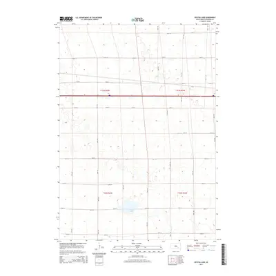
2015 Map of Crystal Lake
USGS Topo · Published 2015About this map
Crystal Lake serves as the central focal point for this section of Aurora County, situated within a landscape defined by the Public Land Survey System. The map documents the intersection of townships t103n r65w, t103n r64w, t102n r65w, and t102n r64w, reflecting the orderly agricultural development of the South Dakota prairie. A dense network of section-line roads, including 258th St and 382nd Ave, structures the rural landscape, illustrating the persistent 19th-century surveying patterns into the modern era. While many midwestern lakes are ephemeral, the prominent presence of this named water body suggests its local importance for drainage and perhaps recreation in an otherwise agrarian expanse dominated by numbered section roads like CR 34 and 251st St.
Find a feature on this map
22 named features on this map. Tap any name to fly to it.
Don’t see what you’re looking for? This feature index may not catch every label — zoom into the map to look around manually.
Map Details
Editions of this 2015 Crystal Lake Map
This is the sole edition of this map. No revisions or reprints were ever made.
Other maps of this area

1899 · Mitchell
USGS Topo · 1:125,000

1942 · Crow Lake
USGS Topo · 1:62,500

1955 · Mitchell
USGS Topo · 1:250,000

1959 · Mitchell
USGS Topo · 1:250,000

1979 · Laffey Lake
USGS Topo · 1:24,000

1979 · Crystal Lake
USGS Topo · 1:24,000

1979 · White Lake
USGS Topo · 1:24,000

1979 · Aurora Center
USGS Topo · 1:24,000

1979 · Storla SW
USGS Topo · 1:24,000

1980 · Stickney
USGS Topo · 1:24,000
Featured Places
- Eureka Township, SD
- Crystal Lake Township, SD
- Plankinton Township, SD
- Pleasant Lake Township, SD
- Aurora County, SD