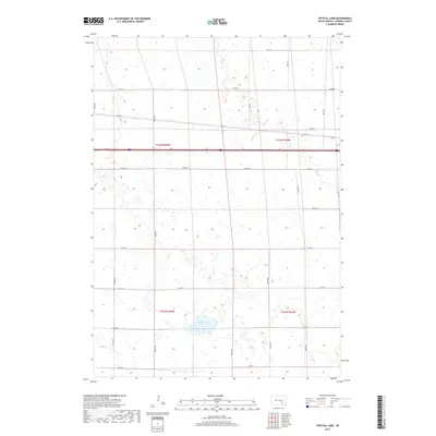
2017 Map of Crystal Lake
USGS Topo · Published 2017About this map
Crystal Lake sits as the central geographic landmark in this Aurora County landscape, providing a natural focal point amidst a highly organized agricultural grid. The terrain is defined by the rectilinear section lines of t102n r65w and surrounding townships, which dictate the placement of local thoroughfares like 380th Ave and Co Rd 30. Bisecting the northern half of the quadrangle is Interstate 90, a major transportation corridor that cuts across the older section-line roads, illustrating the evolution of South Dakota's transit network from local farm-to-market paths to national expressway infrastructure. The map reveals a land heavily influenced by the Public Land Survey System, where modern county roads like Co Rd 44 and Co Rd 48 continue to trace the boundaries established by nineteenth-century surveyors.
Find a feature on this map
26 named features on this map. Tap any name to fly to it.
Don’t see what you’re looking for? This feature index may not catch every label — zoom into the map to look around manually.
Map Details
Editions of this 2017 Crystal Lake Map
This is the sole edition of this map. No revisions or reprints were ever made.
Other maps of this area

1899 · Mitchell
USGS Topo · 1:125,000

1942 · Crow Lake
USGS Topo · 1:62,500

1955 · Mitchell
USGS Topo · 1:250,000

1959 · Mitchell
USGS Topo · 1:250,000

1979 · Laffey Lake
USGS Topo · 1:24,000

1979 · Crystal Lake
USGS Topo · 1:24,000

1979 · White Lake
USGS Topo · 1:24,000

1979 · Aurora Center
USGS Topo · 1:24,000

1979 · Storla SW
USGS Topo · 1:24,000

1980 · Stickney
USGS Topo · 1:24,000
Featured Places
- Eureka Township, SD
- Crystal Lake Township, SD
- Plankinton Township, SD
- Pleasant Lake Township, SD
- Aurora County, SD