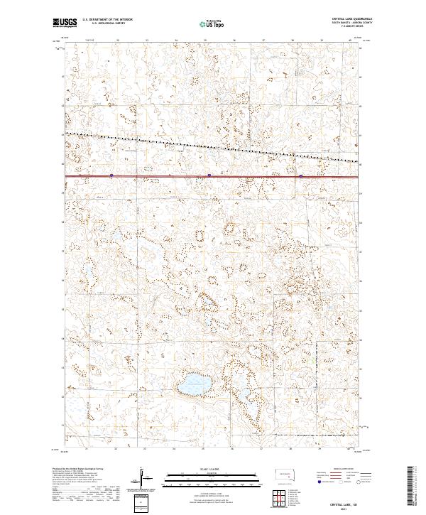
2021 Map of Crystal Lake
USGS Topo · Published 2021About this map
Crystal Lake dominates the southern landscape of this Aurora County township, surrounded by the distinctive grid of the Public Land Survey System. The area is defined by its agrarian structure, with section lines marked by a network of rural roads such as 378th Ave and 384th Ave. This particular region, including townships t103n r65w and t102n r64w, shows the intersection of local travel and modern logistics, where the established county road system meets the high-speed corridor of Interstate 90. The topography is characterized by numerous small wetlands and depressions typical of the South Dakota prairie, creating a complex hydrology around the primary water body. This 2021 survey serves as a precise record of contemporary land use, showing how the historic section-line road pattern remains the backbone of the rural community.
Find a feature on this map
25 named features on this map. Tap any name to fly to it.
Don’t see what you’re looking for? This feature index may not catch every label — zoom into the map to look around manually.
Map Details
Editions of this 2021 Crystal Lake Map
This is the sole edition of this map. No revisions or reprints were ever made.
Other maps of this area

1899 · Mitchell
USGS Topo · 1:125,000

1942 · Crow Lake
USGS Topo · 1:62,500

1955 · Mitchell
USGS Topo · 1:250,000

1959 · Mitchell
USGS Topo · 1:250,000

1979 · Laffey Lake
USGS Topo · 1:24,000

1979 · Crystal Lake
USGS Topo · 1:24,000

1979 · White Lake
USGS Topo · 1:24,000

1979 · Aurora Center
USGS Topo · 1:24,000

1979 · Storla SW
USGS Topo · 1:24,000

1980 · Stickney
USGS Topo · 1:24,000
Featured Places
- Eureka Township, SD
- Plankinton Township, SD
- Crystal Lake Township, SD
- Pleasant Lake Township, SD
- Aurora County, SD