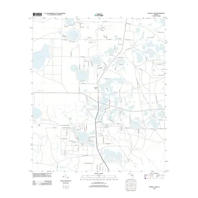
2012 Map of Crystal Lake
USGS Topo · Published 2012About this map
Crystal Lake serves as the focal point for this section of Washington County, Florida, where a dense network of karst topography creates a landscape defined by circular sinkhole lakes and interconnected wetlands. The small community of Crystal Lake is surrounded by numerous named water bodies, including the expansive Big Blue Lake to the west and Compass Lake to the north. Transportation and access are centered around local routes like Chain Lake Rd and Greenhead Rd, while aviation needs are met by the Crystal Village Airport and the nearby CML Airport. The density of these lakes, such as Rattlesnake Lake, Big Island Lake, and the winding River Lakes, indicates a complex hydrological system. For local historians, the residential development pattern is visible through named drives and courts like Cardinal Pl and Quail Ridge Dr near Major Lake.
Find a feature on this map
144 named features on this map. Tap any name to fly to it.
Don’t see what you’re looking for? This feature index may not catch every label — zoom into the map to look around manually.
Map Details
Editions of this 2012 Crystal Lake Map
This is the sole edition of this map. No revisions or reprints were ever made.
Other maps of this area

1943 · West Bay
USGS Topo · 1:24,000

1943 · Southport
USGS Topo · 1:24,000

1944 · Southport
USGS Topo · 1:24,000

1944 · West Bay
USGS Topo · 1:31,680

1944 · Crystal Lake
USGS Topo · 1:24,000

1944 · Bayhead
USGS Topo · 1:24,000

1944 · Bennett
USGS Topo · 1:24,000

1945 · Bennett
USGS Topo · 1:31,680

1945 · Red Head
USGS Topo · 1:31,680

1945 · Bayhead
USGS Topo · 1:31,680