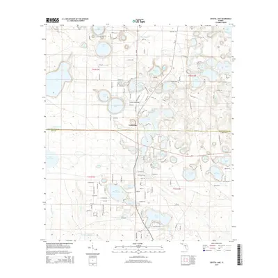
2015 Map of Crystal Lake
USGS Topo · Published 2015About this map
Crystal Lake and the surrounding panhandle sandhills characterize this Florida landscape, where the Washington Co - Bay Co line bisects a densely clustered network of karst ponds and named lakes. The terrain is defined by its unusual hydrography, featuring distinct basins like Compass Lake, Big Island Lake, and Court Martial Lake. Transportation through the area is anchored by Highway 20, which runs east-to-west across the central portion of the map, and the Crystal Village Airport serving local aviation needs. The 2015 survey reveals a pattern of rural residential growth, particularly north of Highway 20, with a web of named roads such as Quail Ridge Dr and Turkey Run Rd weaving between larger water bodies like Open Lake and Long Lake. This collection of features implies a region deeply connected to its aquatic geography, with settlement and recreation historically organized around the numerous ponds and sloughs.
Find a feature on this map
91 named features on this map. Tap any name to fly to it.
Don’t see what you’re looking for? This feature index may not catch every label — zoom into the map to look around manually.
Map Details
Editions of this 2015 Crystal Lake Map
This is the sole edition of this map. No revisions or reprints were ever made.
Other maps of this area

1943 · West Bay
USGS Topo · 1:24,000

1943 · Southport
USGS Topo · 1:24,000

1944 · Southport
USGS Topo · 1:24,000

1944 · West Bay
USGS Topo · 1:31,680

1944 · Crystal Lake
USGS Topo · 1:24,000

1944 · Bayhead
USGS Topo · 1:24,000

1944 · Bennett
USGS Topo · 1:24,000

1945 · Bennett
USGS Topo · 1:31,680

1945 · Red Head
USGS Topo · 1:31,680

1945 · Bayhead
USGS Topo · 1:31,680