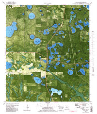
1982 Map of Crystal Lake
USGS Topo · Published 1983About this map
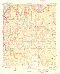
The dense karst landscape of the Florida Panhandle is strikingly visible in this orthophotomap, where the boundary of Washington Co and Bay Co cuts through a high concentration of circular sinkhole lakes. This specialized topographic study uses aerial imagery from the mid-1970s to provide a photographic view of the terrain, contrasting the geometric patterns of managed timberlands and clearings against the irregular shorelines of water bodies like Big Blue Lake and Compass Lake. In the northern section, prominent features such as Open Lake and Major Lake dominate the wooded interior. Further south, the landscape becomes increasingly fragmented by smaller basins including Bream Lake, Fivemile Lake, and Shirt Tail Lake. Traces of human activity are sparse but distinct, from the secluded Landing Strip near Court Martial Lake to the drainage networks of Cedar Creek and North Branch.
Find a feature on this map
34 named features on this map. Tap any name to fly to it.
Don’t see what you’re looking for? This feature index may not catch every label — zoom into the map to look around manually.
Map Details
Editions of this 1982 Crystal Lake Map
2 editions found

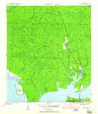
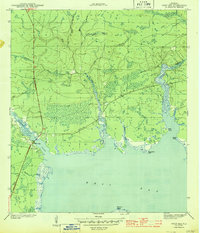
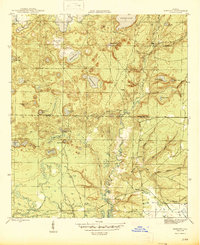
Other maps of this area

1943 · West Bay
USGS Topo · 1:24,000

1943 · Southport
USGS Topo · 1:24,000
1944 · Southport
USGS Topo · 1:24,000
1944 · West Bay
USGS Topo · 1:31,680

1944 · Crystal Lake
USGS Topo · 1:24,000

1944 · Bayhead
USGS Topo · 1:24,000

1944 · Bennett
USGS Topo · 1:24,000
1945 · Bennett
USGS Topo · 1:31,680
1945 · Red Head
USGS Topo · 1:31,680
1945 · Bayhead
USGS Topo · 1:31,680