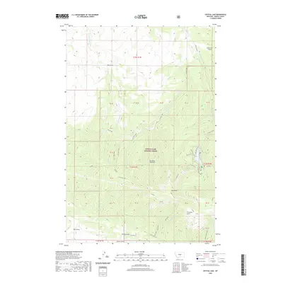
2020 Map of Crystal Lake
USGS Topo · Published 2020About this map
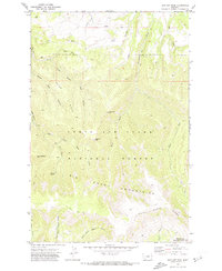
The Big Snowy Mountains dominate this high-elevation landscape within the Lewis & Clark National Forest. The geography is defined by a central massif containing prominent summits such as W Peak and West Peak, which serve as the headwaters for a complex drainage system. Waterways like Dry Pole Creek, Buffalo Cr, and Neil Creek radiate from these heights, carving deep drainages like Green Pole Canyon and West Gulch. The road network is sparse, centered on the recreational corridor of Crystal Lake Rd and the Crystal Lake Loop. Geologists and surveyors will note the numerous public land tracts identified by PB labels, such as PB 45 and PB 46, which suggest specific land use histories or historic parcels in this montane environment. High-altitude landmarks like Grand View and Promontory Point provide specific geographic orientation for those tracing the terrain of central Fergus County.
Find a feature on this map
46 named features on this map. Tap any name to fly to it.
Don’t see what you’re looking for? This feature index may not catch every label — zoom into the map to look around manually.
Map Details
Editions of this 2020 Crystal Lake Map
This is the sole edition of this map. No revisions or reprints were ever made.
Other maps of this area

1889 · Big Snowy Mountain
USGS Topo · 1:250,000

1893 · Big Snowy Mountain
USGS Topo · 1:250,000

1954 · Roundup
USGS Topo · 1:250,000

1958 · Roundup
USGS Topo · 1:250,000

1970 · Crystal Lake
USGS Topo · 1:24,000

1970 · Moore
USGS Topo · 1:24,000
1970 · West Fork Beaver Creek
USGS Topo · 1:24,000
1970 · Moore SW
USGS Topo · 1:24,000
1970 · Castle Butte
USGS Topo · 1:24,000
1970 · Jump Off Peak
USGS Topo · 1:24,000