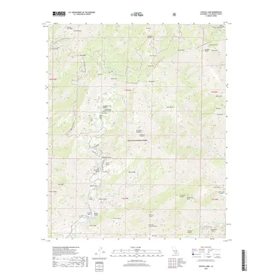
2018 Map of Crystal Lake
USGS Topo · Published 2018About this map
Crystal Lake serves as a central landmark in this high-elevation region of the Angeles National Forest, where steep canyons and ridges define the landscape. The geography is characterized by a dense network of seasonal and permanent water sources, including Little Jimmy Spring, Lily Spring, and Big Cienega, which feed into major drainages like the N Fork San Gabriel River and the Iron Fork. Evidence of recreational development and historical trail use is prominent, with the Pacific Crest National Scenic Trail traversing the northern ridges through Islip Saddle and Vincent Gap. Peaks such as Mt Baden-Powell and Mt Islip provide significant vertical relief, overlooking specialized features like the BSA Monument and the Yerba Santa Amphitheater near the Pine Flats campground. The road network is restricted to primary arteries like San Gabriel Canyon Rd, emphasizing the area's role as a protected wilderness and outdoor destination.
Find a feature on this map
79 named features on this map. Tap any name to fly to it.
Don’t see what you’re looking for? This feature index may not catch every label — zoom into the map to look around manually.
Map Details
Editions of this 2018 Crystal Lake Map
This is the sole edition of this map. No revisions or reprints were ever made.
Other maps of this area

1894 · Pomona
USGS Topo · 1:62,500

1897 · Pomona
USGS Topo · 1:62,500

1897 · Cucamonga
USGS Topo · 1:62,500

1898 · Pomona
USGS Topo · 1:62,500

1900 · Cucamonga
USGS Topo · 1:62,500

1901 · Southern California Sheet No. 1
USGS Topo · 1:250,000

1903 · Rock Creek
USGS Topo · 1:62,500

1903 · Cucamonga
USGS Topo · 1:62,500

1903 · San Antonio
USGS Topo · 1:62,500

1904 · Pomona
USGS Topo · 1:62,500