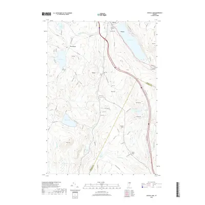
2018 Map of Crystal Lake
USGS Topo · Published 2018About this map
The Barton River valley serves as the central corridor for this 2018 survey of Vermont's Northeast Kingdom, connecting the villages of Barton and Orleans. The landscape is defined by its glaciated basins, most notably the deep waters of Crystal Lake and the smaller, high-elevation Lake Parker near West Glover. Significant topographic variation is evident in the surrounding hills, including Still Hill and Lone Tree Hill, which rise sharply from the valley floor.
Find a feature on this map
90 named features on this map. Tap any name to fly to it.
Don’t see what you’re looking for? This feature index may not catch every label — zoom into the map to look around manually.
Map Details
Editions of this 2018 Crystal Lake Map
This is the sole edition of this map. No revisions or reprints were ever made.
Other maps of this area

1919 · Lake Memphremagog
USGS Topo · 1:62,500

1920 · Derby
USGS Topo · 1:62,500

1920 · Irasburg
USGS Topo · 1:62,500

1923 · Irasburg
USGS Topo · 1:48,000

1923 · Lake Memphremagog
USGS Topo · 1:48,000

1925 · Irasburg
USGS Topo · 1:62,500

1925 · Memphremagog
USGS Topo · 1:62,500

1928 · Hardwick
USGS Topo · 1:62,500

1934 · Hardwick
USGS Topo · 1:48,000

1935 · Lyndonville
USGS Topo · 1:48,000