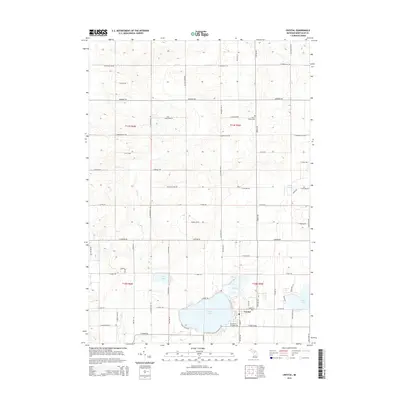
2014 Map of Crystal
USGS Topo · Published 2014About this map
Crystal serves as the central hub of this 2014 survey, situated on the southern shore of the prominent Crystal Lake. The township's landscape is defined by a dense network of sectional roads and a series of smaller water bodies including Loon Lake, Mud Lake, and Duck Lake. In the northern portion of the quadrangle, Fish Cr meanders through the township's agricultural blocks. Local history is anchored by the Ferris Center Cem along E Newcomb Rd, which stands as a quiet marker of the area's rural development. The road system, including thoroughfares like McBrides Rd and E Stanton Rd, connects the scattered farms and lakeside residences, illustrating the enduring transition from early agricultural tracts to modern recreational and residential use around the larger lakes.
Find a feature on this map
57 named features on this map. Tap any name to fly to it.
Don’t see what you’re looking for? This feature index may not catch every label — zoom into the map to look around manually.
Map Details
Editions of this 2014 Crystal Map
This is the sole edition of this map. No revisions or reprints were ever made.
Other maps of this area

1954 · Midland
USGS Topo · 1:250,000

1958 · Midland
USGS Topo · 1:250,000

1959 · Midland
USGS Topo · 1:250,000

1964 · Edmore
USGS Topo · 1:24,000

1964 · Stanton
USGS Topo · 1:24,000

1965 · Vestaburg
USGS Topo · 1:24,000

1965 · Sumner
USGS Topo · 1:24,000

1965 · Crystal
USGS Topo · 1:24,000
1965 · Riverdale
USGS Topo · 1:24,000

1966 · Midland
USGS Topo · 1:250,000