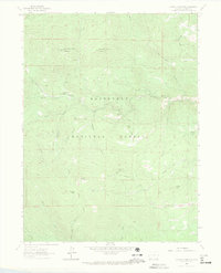
1962 Map of Crystal Mountain
USGS Topo · Published 1970About this map
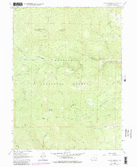
Roosevelt National Forest dominates this section of the Colorado high country, where peaks like West White Pine Mountain and East White Pine Mountain reach above the timberline. The landscape in the early 1960s is defined by a network of resource management and early recreation routes, including numerous Jeep Trails and Pack Trails that connect the Buckhorn Ranger Sta to remote landmarks. A Lookout Tower sits atop one of the summits, while significant elevations like Crystal Mountain and Lookout Mountain overlook the drainage basins of Buckhorn Creek and the North Fork Fish Creek. Human presence is marked by scattered mining activity, noted simply as Mine and Quarry, and the topographic divide at Donner Pass. The map reveals a transition between the lower elevations of Box Prairie and the steep slopes of Bulwark Ridge, reflecting the mid-century utility of the national forest for both fire observation and natural resource extraction.
Find a feature on this map
30 named features on this map. Tap any name to fly to it.
Don’t see what you’re looking for? This feature index may not catch every label — zoom into the map to look around manually.
Map Details
Editions of this 1962 Crystal Mountain Map
7 editions found
Other maps of this area

1905 · Mount Olympus
USGS Topo · 1:62,500

1907 · Mount Olympus
USGS Topo · 1:62,500

1907 · Livermore
USGS Topo · 1:125,000

1909 · Livermore
USGS Topo · 1:125,000

1915 · Longs Peak
USGS Topo · 1:125,000

1916 · Home
USGS Topo · 1:125,000

1919 · Rocky Mountain National Park
USGS Topo · 1:125,000

1920 · Home
USGS Topo · 1:125,000

1954 · Greeley
USGS Topo · 1:250,000

1957 · Greeley
USGS Topo · 1:250,000