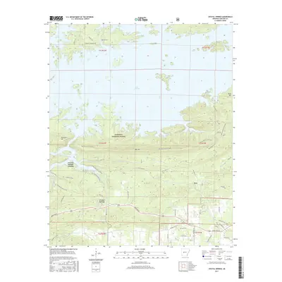
2017 Map of Crystal Springs
USGS Topo · Published 2017About this map
Lake Ouachita dominates the northern landscape of this survey, with its intricate shoreline forming numerous coves and inlets within the Ouachita National Forest. The settlement of Crystal Springs serves as a central hub, connected to the waterfront by Crystal Springs Landing. The terrain is defined by significant ridges, including the east-west span of Bear Mtn and the prominent Hickorynut Mtn.
Find a feature on this map
53 named features on this map. Tap any name to fly to it.
Don’t see what you’re looking for? This feature index may not catch every label — zoom into the map to look around manually.
Map Details
Editions of this 2017 Crystal Springs Map
This is the sole edition of this map. No revisions or reprints were ever made.
Other maps of this area

1890 · Hot Springs
USGS Topo · 1:125,000

1894 · Hot Springs
USGS Topo · 1:125,000

1955 · Little Rock
USGS Topo · 1:250,000

1956 · Little Rock
USGS Topo · 1:250,000

1960 · Little Rock
USGS Topo · 1:250,000

1962 · Crystal Springs
USGS Topo · 1:24,000

1962 · Avant
USGS Topo · 1:24,000

1962 · Fannie
USGS Topo · 1:24,000

1962 · Mc Graw Mountain
USGS Topo · 1:24,000

1964 · Little Rock
USGS Topo · 1:250,000