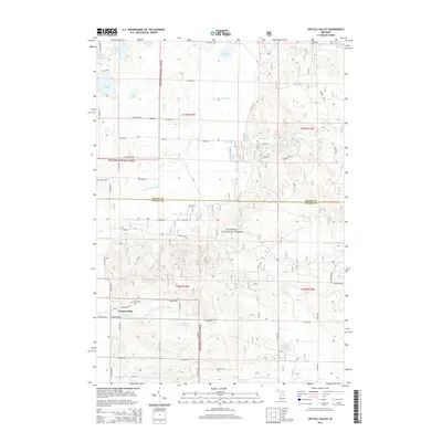
2014 Map of Crystal Valley
USGS Topo · Published 2014About this map
Crystal Valley and the surrounding woodlands of the Manistee National Forest define this landscape in eastern Mason and Oceana Counties. The area is characterized by a high density of small lakes and winding watercourses, including Eden Lake, Woodruff Lake, and the meandering N Br Pentwater River. Settlement is sparse, anchored by the community of Fern in the north and Crystal Valley in the south. These small hubs, connected by a grid of named local roads like E Anthony Rd and Madison Rd, provide a window into the rural life of West Michigan at the start of the 21st century. Genealogists can identify key landmarks such as Mt Malissa Cem and Eden Cem, which serve as permanent markers of the families who settled this timbered terrain. The presence of numerous creeks, such as Whiskey Cr and Ruby Cr, highlights the drainage patterns that shaped the local economy and land use.
Find a feature on this map
50 named features on this map. Tap any name to fly to it.
Don’t see what you’re looking for? This feature index may not catch every label — zoom into the map to look around manually.
Map Details
Editions of this 2014 Crystal Valley Map
This is the sole edition of this map. No revisions or reprints were ever made.
Other maps of this area

1931 · Custer NW
USGS Topo · 1:31,680

1931 · Custer SW
USGS Topo · 1:31,680

1931 · Custer NE
USGS Topo · 1:31,680

1931 · Walkerville NE
USGS Topo · 1:31,680

1931 · Hart NE
USGS Topo · 1:31,680

1931 · Walkerville NW
USGS Topo · 1:31,680

1931 · Custer SE
USGS Topo · 1:31,680

1932 · Ludington NE
USGS Topo · 1:31,680

1932 · Ludington SE
USGS Topo · 1:31,680

1954 · Milwaukee
USGS Topo · 1:250,000